Archive for the ‘river’ Category
Think you know South American paddling? Maybe you’ve been to Chile? Ecuador? Well, the Andes offer much more. A new playground is opening up: northern Peru. It’s got big clean water, multi-days, and lots of creeks.
James “Rocky” Contos of SierraRios has done more in the past couple years to open up Peru to paddlers than anyone since perhaps the Canoandes expedition of 1979. Besides discovering the true source of the Amazon (see below**) he has been running commercial trips, two to four weeks long, on the Amazon’s biggest tributary, the Río Marañon. This is an amazing Grand-Canyon style trip. The Río Marañon cuts a course north almost all the way to the Ecuador border before curving east to feed the Amazon basin.
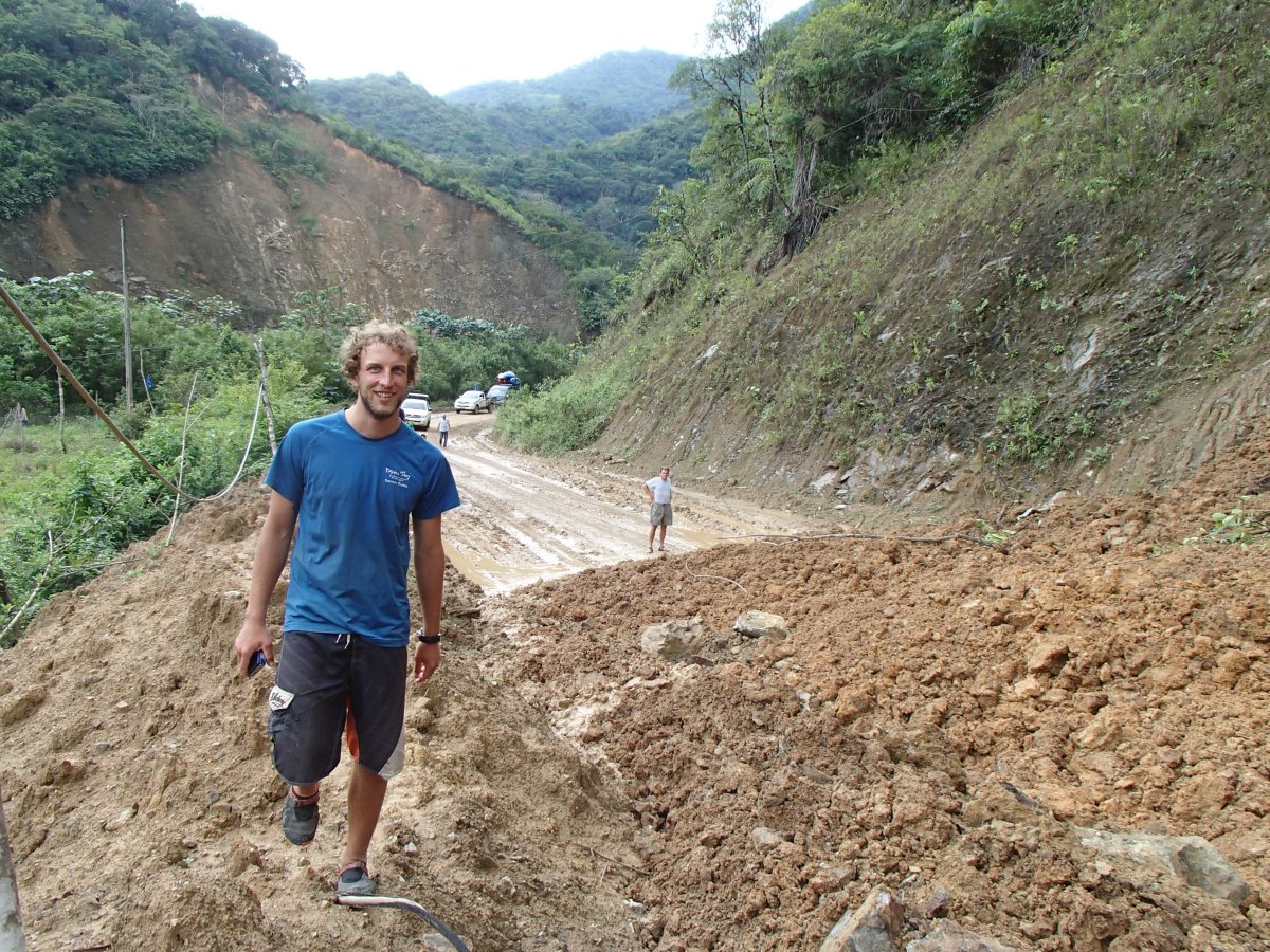
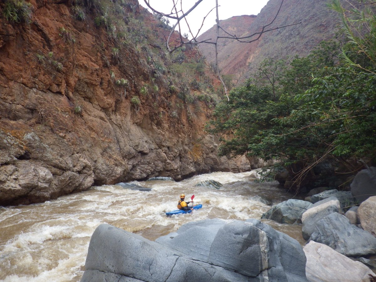
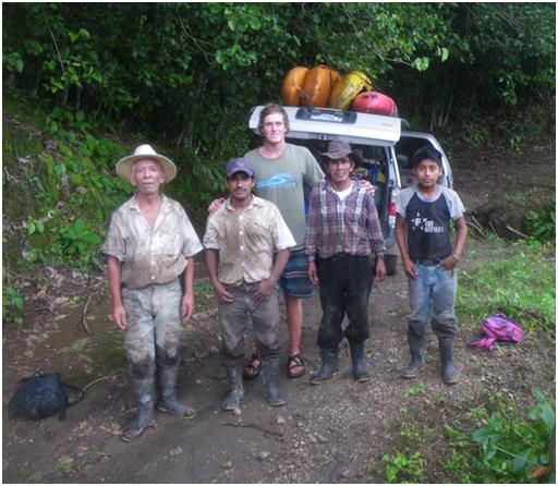
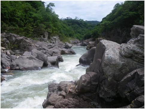
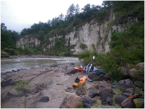
In early February, a group was finishing off a Marañon trip and Rocky invited some of the better kayakers to join him in exploring some of the bigger tributaries of the Marañon, and Kurt Casey of Peruwhitewater.com and myself hopped onboard. There were nine of us (see below for the names*) who met in Bagua which was our just-outside-the-jungle base for the first river we wanted to explore, the Río Chinchipe. Some parts of this big river (> 10,000 cfs at the confluence) have been run, but as far as we knew no one had attempted it from as high as Rocky had planned…from inside Ecuador! We drove to the border the first day and negotiated our return passport stamps with the officials before venturing into Ecuador the next day. Here the roads became dirt but were passable by our minivan until mid-afternoon until we were blocked by a landslide just outside Palanda. There was nothing to do but leave the boats with a farmer, hoof it to Palanda, and hope the road would open overnight and we could retrieve our boats in the morning. Which did in fact happen. There were several large tributaries to choose from as starting points (future explorers take note) but we opted for what seemed a likely first descent on the Chinchipe’s main tributary, the Río Numbala, putting in at an elevation of 940 m, below a > 100 ft/mi section (next time), about 8 km from Palanda. Rocky estimated a four-day trip, which panned out.
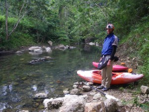
Jesse searching for a put in
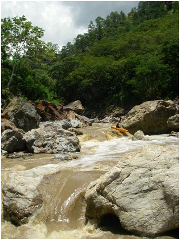
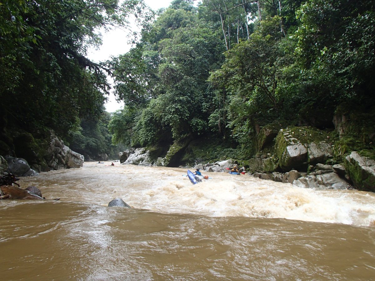
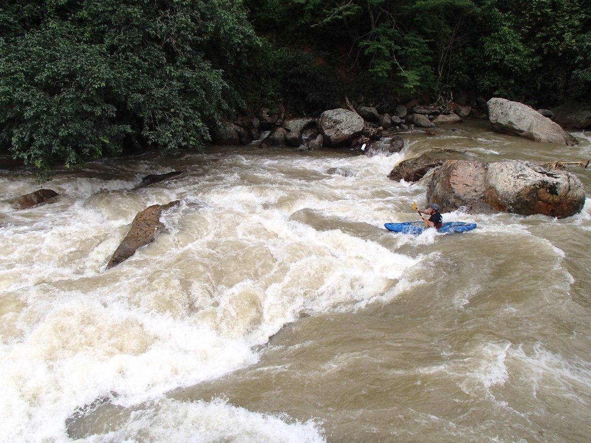
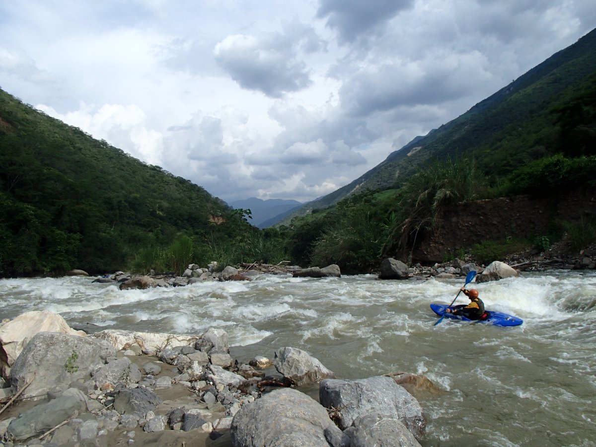
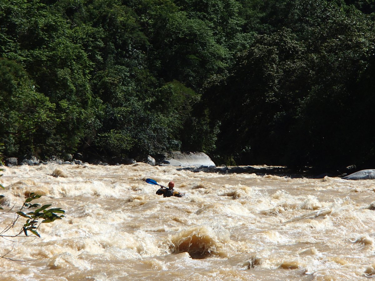
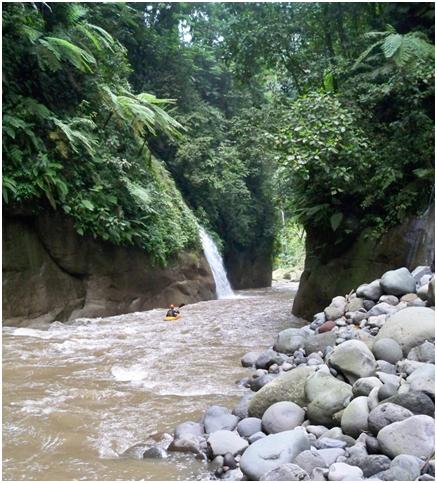
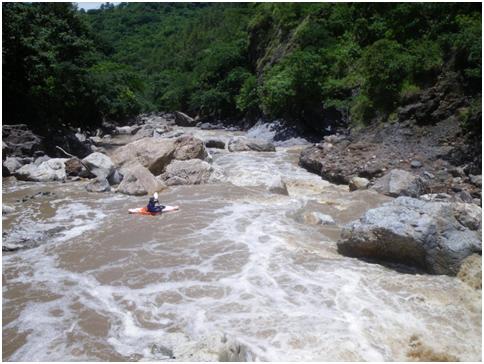
The Numbala was already running > 2000 cfs at that point with busy rapids full of waves and holes. Our goal that day was to meet our raft coming down on the Río Canchis border run, which seemed pretty doubtful considering the 48 km distance, but the jungly solid class IV river turned out to be all read-n-run and despite some flips in the holes there was nothing much to slow us down and we found the rafters at camp shortly below the confluence. We were all beaming from an exciting run and looking forward to more. The next three days the rapids were more spaced out but there was plenty of excitement. The big feature on the second day was the IV+ Naranja rapid, a fearsome stairstep rapid near the road. Rocky rowed the raft, and we all had clean runs, on chicken lines or otherwise. On the morning of the third day we scouting another big rapid which turned out to be pretty clean and offered a fun surf wave at the bottom. By the fourth day things had calmed down quite a bit and we made to the Marañon and the last big wave train rapid shortly after mid-day. Camps were plentiful, pretty, and largely bug-free which was a bonus.
down the Numbala
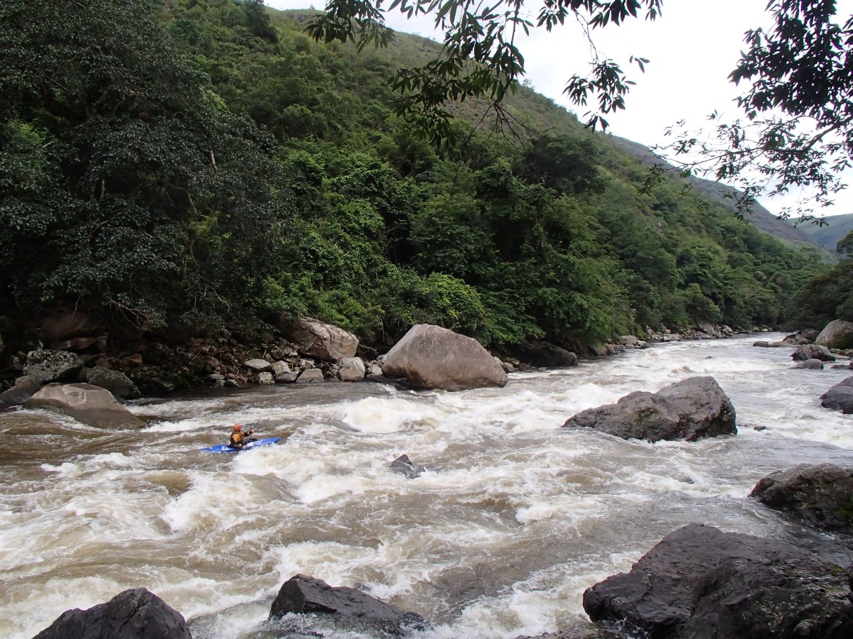
above Naranja rapid
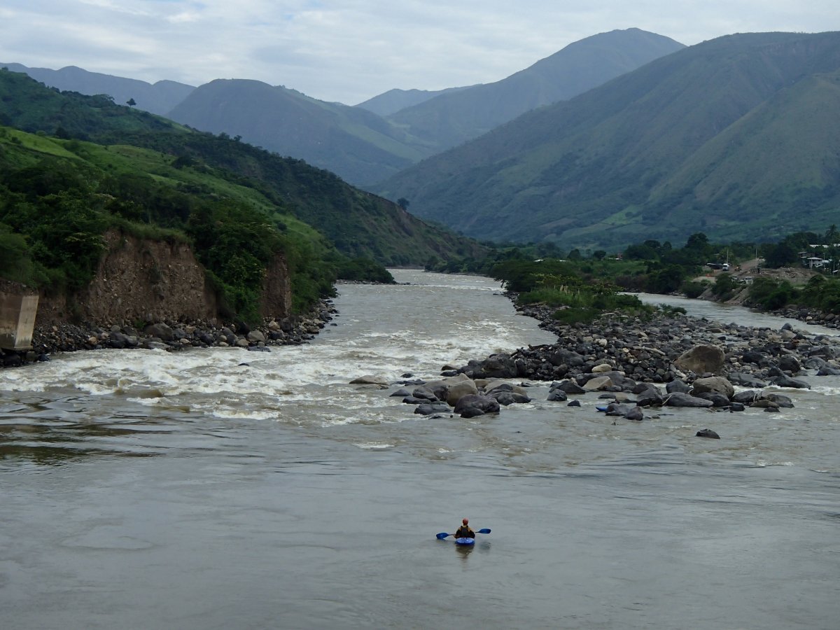
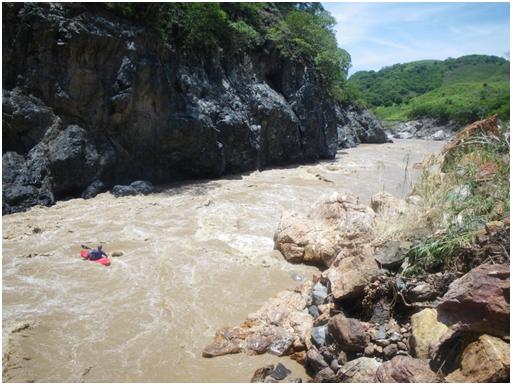
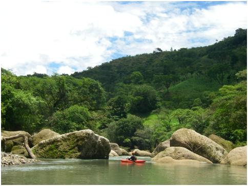
After helping Rocky ship back the expedition gear to Huaraz, and bidding goodbye to our rafter Ira, local guide Luciano, and kakayers Jesse and Scott, the next mission was the Huancabamba, higher up and a bit to the west. This was to be kayak self-support, again four days, so we dropped off our luggage at Jaen (nearby and civilized and our base for the rest of our stay), and drove eight hours into the night and up the mountain to the town. The Huancabamba area was more arid, though it drizzled on us the first day. This was another enjoyable trip with varied desert-like scenery and changing landscape colors. Flow started at a measly 200 cfs but finished well over 2000 cfs. The difficulty was mostly class III with the exception of fun class IV creeky canyon sections the first and second day, and some big water class IVs the last days. The third day we had to paddle across a reservoir created by a dam (diverting water to the Pacific side through a tunnel!) but even that turned into a nice experience as the dam workers helped us portage our stuff to the outlet and even gave us lunch. In general we found the Peruvians very curious about our adventures and proud of their natural resources.
Lorenzo on the upper Huancabamba

Kurt and Josh on the lower Huancabamba
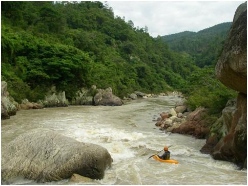
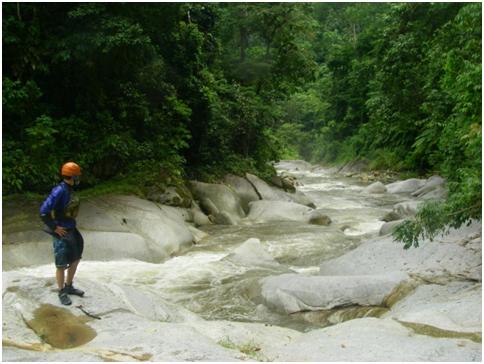
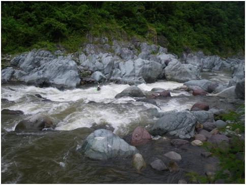
On the fourth day the consummate explorer Rocky paddled the Huancbamba all the way to the hot springs at the Marañon while the rest of us opted to take-out near Jaen. After the Huancabamba it was Kurt and Lorenzo’s turns to head back home, which left Rocky, Josh, and I to continue playing. Our next missions were on rivers that we found while driving or running the first two, all of which turned out to be stellar and turned the difficulty up a notch. First was the Río Chunchuca, 30 km long starting at Chunchuquillo, running at over 2500 cfs with some short sections tilted to 100 ft/mi. The road up is along the river, which was wall-to-wall waves and holes, but it was these steeper sections that gave us some pause. After an hour we got to the first long steep rapid which precipitated some bouldery and brushy portaging. To save time we portaged the next steep parts wholesale, climbing up to some fields and cutting across. We probably portaged a full kilometer all together. On most of the river we moved fast however, and the stormy sea rapids were a hoot. Josh and Rocky christened it the NF Payette of Peru.
Josh on the Chunchunca
the runnable run-out
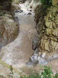
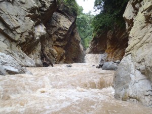
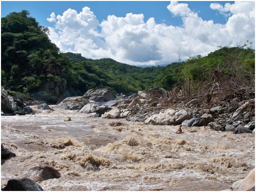
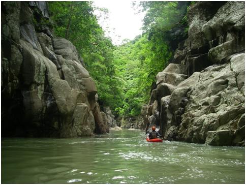
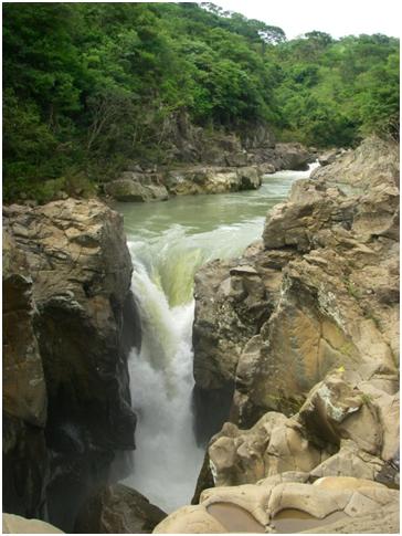
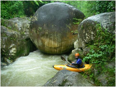
At this point Josh had to depart so it was left to just Rocky and me to tackle what turned out to the be the toughest river of the trip: the Chirinos. This big clean river comes into the Chinchipe river-left, which meant a car ferry at Puerto Ciruelo (soon to have a bridge) and then 3 more hours of dirt road. The view of the downstream V-shaped canyon was daunting, especially with 4500 cfs of tea-colored water flowing by with an average gradient of 60 ft/mi, but we put on at 1pm anyway. Just as we congratulated ourselves at passing one rapid, another steeper and longer one would appear. We started running the chicken lines along the shore. We made good progress until about 4:00pm when a class V sequence appeared with a cliff on the left and a fresh rockslide on the right. After some scouting we portaged the beast. Soon after we encountered another steep class V rapid with another grunt of a portage. Things started to ease up a bit but we were still going slow down some chicken lines, then over easier II/III at dusk. Eventually darkness took over and we bivouaced in small caves (I displaced a scorpion in mine) for the night. The next morning it was one big but boat scoutable rapid and then straightforward down to the confluence. We were just 1 km away the night before.
good stuff on the Chirinos

too good
The road back to Jaen passed by another interesting river that was also running full, the Tabaconas, so we decided to make the best of the situation and hopped on that. The Tabaconas was another with good road scouting and turned out to be one big bouncy toboggan ride for about 20 km before getting flatter for the last few kms. Great fun, and raftable, though it would take a little skill to stay out of the trees.
Greg in the big bouncy Tabaconas
All in all I just can’t say enough about the river running potential in this almost unknown part of Peru. We checked out a couple smaller creeks also that didn’t have enough water, but there are plenty more in the area to explore. Come check it out, maybe in conjunction with a raft-supported Marañon trip, or on your own. SierraRios has gear for rent which is helpful the way airlines are these days.
Some of these rivers are already written up on peruwhitewater.com, another good resource for Peru beta.
* Paddlers participating included Kurt Casey, Josh Fischer, Scott McBride, Lorenzo Bergamin, Jesse Mogler, Rocky Contos, Greg Schwendinger, rafter Ira Estin, and local guide Luciano Troyes from Jaen who runs the nearby Gotas de Agua nature reserve.
** Here are some links to news/scientific articles covering Rocky’s Amazon source discoveries:
http://news.nationalgeographic.com/news/2014/02/140213-amazon-river-length-source-maps-science/
http://www.foxnews.com/science/2014/02/14/scientists-weve-found-amazon-river-true-source/?intcmp=features
http://www.larepublica.pe/08-03-2014/la-naciente-del-amazonas-esta-en-el-rio-mantaro
(and the scientific article itself) https://www.dropbox.com/s/q25modceshibnsw/AREA_ContosTripcevich.pdf
…in Guatemala, in the cycle of the (long-count) Mayan calendar ended Dec 21, that is.
4 kayakers from Rios Guatemala and mayanwhitewater.com set off to explore the lower Río Machaquilá in the jungly Petén region of Guatemala. It was more of a scenic/research trip than a hard-core whitewater trip, but the video is fun and shows what it’s like to do a multi-day expedition in Guatemala.

(click to see video)
enjoy!
Greg
A week ago I found myself high up in the drainage of the Río Madre Vieja. The lower Madre Vieja has been known for a few years now as the “fastest drop around”, dropping continuously at 140 ft/mi but hardly needing a scout. I’ve dropped the 1600 feet in 2.5 hours without breaking a sweat. Anyway, I hadn’t gotten up higher before due to 1. lack of car access, 2. lack of water, and 3. the intimidating gradient (200+ ft/mi) and narrow canyons up there.
Just 2 months ago a friend of mine, Axel Alburez, went hiking up there, looking for a canyoning-camp route. They estimated 4 hours to hike 4 km of the river. When they hadn’t shown up by noon the 2nd day several of us starting making plans to go in and the look for him the 3rd day. As it turned out they found their way out just before dark the 2nd day. They reported a deep narrow canyon with many cliffed-in waterfalls that forced them to climb up and down constantly. However, at their exit point, 3 km above the known kayak put-in and only 1 hour from a road, the canyon appeared to be mellowing a bit and he guessed it to be more runnable. Thus was formed the challenge in my mind.
On July 4th independence was gained. We arrived at the trailhead under a cloudy sky. A couple local kids volunteered to be our trail guides, and in 45 minutes we were at the river with a nice low first-descent flow, about 250 cfs. The first 10 minutes was fun boogie-water, then at the first steeper bit I got out of my boat. While scouting, I turned around to see my boat running the rapid without me! I hate it when I’m stupid. I was almost able to grab it as it went by me, then I was off and boulder-hopping to keep up with it. As the rapid curved I looked up to see the river dropping between two cliffs. I was thinking that if I didn’t stop the boat now I may never see it again. Luckily right then it eddied-out just long enough for me to grab it. After catching my breath it was time to scout the drop into the chasm. Oh, did I mention I was alone?
As it turned out I was looking at the entrance of the first of four mini-canyons on this run. This first one was the most spooky, with a good-sized cliffin-in drop at both the entrance (a 12 ft-slide) and exit (16 ft-slide). Luckily both drops were good to go, though it took a bit of strenous climbing to verify. In fact the run is fun as heck, and an incredible experience visually. Definitely one of the best runs on the Pacific side of Guatemala. With all the scouting it took me 2 hours to go only 3 km, but who’s in a hurry?
There’s still plenty left to discover in this part of the world, folks!
For a video summary (warning: low production values), see: upper Madre Vieja on YouTube
Hi everyone,
Anyone who has ever thought of paddling in Chiapas, Mexico, either in person or virtually, should check out the Chiapas river guide on mayanwhitewater.com. All the known runs are now described, and charted on the map. Check it out! Some fantastic whitewater awaits!
www.mayanwhitewater.com


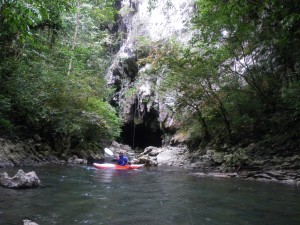
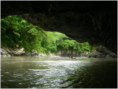
March saw a return to the amazing Candelaria Caves in Guatemala. Have you ever paddled inside a cave for hours? This is a beautiful and unique place to be sure. Along this time was Marco from Italy.
put-in
Very few people, much less kayakers, have seen all the caves we get to.
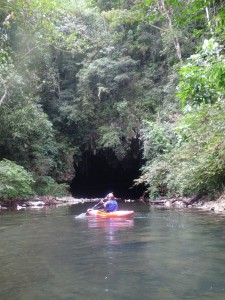
approaching the 1st entrance
This is a great trip for kayakers of all levels. Just remember your headlamp!
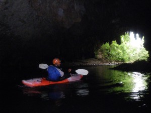
inside the first entrance
The “window” scenery is spectacular.
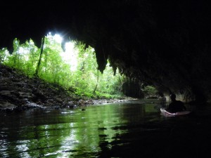
window from inside the cave
There are 8 caves in all. On this date we went through the 1st four.
exiting the 1st cave
A great addition to any paddle tour of Guatemala.
A week after the El Salvador-Honduras trip, I teamed up with the Guatemala Rafting team (Maarten Bleijerveld, Andrew Hawley, and Logan Hartle) for a week to find some fun stuff in Guatemala. Luckily with all the rain we’ve had this year, that wasn’t too hard. We stayed within 100 miles of Antigua, mostly on the Pacific coast except for a 1st descent on a hidden piece of the Río Motagua.
On my last trip report I wrote “things went pretty smoothly”. That was not the case this time. Briefly:
- Coordination. The plan was to meet at a bridge in central Guatemala. Well, the bridge had been swept away 2 months ago in a flood. So the boys crossed the 5000 cfs river with their bags inside.
- Illness. The first night Andrew ended up testing positive for not one tropical disease (dengue fever), not two (hepatitis A), but three (typhoid fever).
- Vehicle. We broke a weld on a shock support, so the ‘ole 4Runner was out of commission for a day (so we used the local “chicken buses” that day).
- Boats. After cracking 2 boats on the last trip, I cracked another one on this trip (Pyranha Micro).
- Roads. This year’s rains have been hard on the put-in roads. We never even made it to the put-in of a couple of the runs I had planned.
- Floods! And Class VI! On the very last run of the trip (1st descent) Logan and I watched the water come up on us during a mini-flash flood. We continued anyway and got to a rapid of extreme consequence and bailed on the not-fully-scoutable/under-a-log line. The portage was of hellish proportions so we opted to hike out without the boats (2 hours of continuous climbing through bamboo thickets which was better than the vertical walls on the other side of the canyon) but we got stuck out overnight anyway, completely unprepared. We fought off mosquitoes and shivers all night, found a dirt road hiked out the rest of the way in the morning, and then went back in at 11:00 with four friendly locals for a 6-hour ordeal down-and-up with the boats.
Still we managed to get in some decent boating! Here’s the itinerary:
- Bottom bit of Río Motagua. It was huge (5000 cfs) and probably the highlight of the trip. It was a first descent and from Google Earth I knew we would see some big stuff. We portaged several V+/VI and ran some super fun IV+/V-.
- Pantaleón. This creek drops continuously over the freshest volcanic sand around.
- Ocosito. The narrow creeky canyons and “blind alleys” were as fun as ever. All the lower crevasses were blocked with boulders so had to be portaged.
- Nahualate. This classic raft run was running high and didn’t let up top to bottom.
- Cutzán. More granite boulders than you can shake a paddle at in this creek.
- Xayá (upper Coyolate). 1st descent. We paddled through some amazing canyons before we reached the class VI. If the big log ever flushed out maybe there’s a line there.
As always, all the rivers will eventually be described and mapped on www.mayanwhitewater.com
Below you can enjoy some photos:
1. Río Motagua. Andrew heading down after the 1st scout (photo GS)
2. Río Motagua. Greg and Logan picking their routes (photo MB)
3. Río Ocosito. Logan about to let Maarten go (photo GS)
4. Río Xayá. Nice canyon (photo LH)
5. Río Xayá. Logan poses with the guys who saved our asses (photo GS)
MayanWhiteWater (that’s me Greg Schwendinger/Guatemala) and SierraRios (that’s Rocky Contos/California-Mexico) teamed up last week to explore some new runs. The stats:
- 10 days of boating in 3 countries (El Salvador, Honduras, Guatemala)
- 7 first descents (all but 2 had some class V)
- 1 multi-day (3 days on the Río Otoro, Honduras)
- 1 camp site flooded at midnight (Río Otoro)
- 2 cracked boats (a Pyranha M3 and a Bliss-stick Huka)
- 1 paddle lost and recovered
Other than that things went pretty smoothly (no swims, no unplanned overnights). Plus we got in a good day on the Río Cangrejal, Honduras, with the owner of Omega Tours, Udo Witteman. All the rivers will eventually be described and mapped on www.mayanwhitewater.com
Below you can enjoy some photos:
1 Scenery on the upper Torola, El Salvador (photo RC)
2 Nice gorge on the upper Torola, El Salvador (photo RC)
3 Tricky rapid above “The Crack” on the upper Río Torola, El Salvador (photo GS)
4 “The Crack” on the upper Río Torola, El Salvador (photo RC)
5 Runout on the Río Yaguera, Honduras (photo RC)

6 Nice canyon on the Río Otoro, Honduras (photo RC)
7 Side cave on the Río Otoro, Honduras (photo RC)
8 Camp on the Río Otoro, Honduras (photo GS)
9 “Beach Ball” rapid on the upper Río San Juan, Honduras (photo RC)
10 Scouting the middle Río San Juan, Honduras (photo RC)
11 “Extended Play”rapid on the Río Cangrejal, Honduras (photo GS)
12 Class III on the Río San José, Guatemala (photo GS)
13 Class IV on the Río San José, Guatemala (photo RC)