Aug 12 2009
AVON DESCENT – The Best in the West

The confusion and the cold
The Avon Descent the longest down river race in Western Australia.
Its got everything a sweet water paddler could wish for…long pools winding through native bush, dense ti tree slalom course, excting grade 2-3 raids, with enough technical tiwsts to keep you honest and marathon distance flatwater home …sometimes into a stiff sea breeze to make sure you know you’ve got a challenege on your hands.
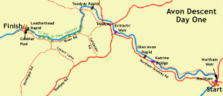
Day One: Northam to Cobbler Pool, 57 km
- Mainly moving flatwater. In low water years it can be shallow with sandbanks.
- Man-made obstacles: Northam Weir, Extract’s Weir. Portage is optional. Katrine Bridge is dangerous in high water and there may be compulsory portage.
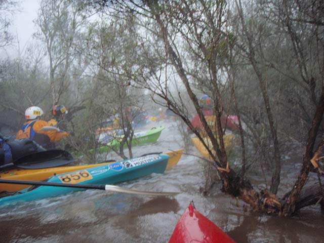
- 11 km of ti-tree thicket with channels alternating with pools
- Small Grade 1-2 rapids: Glen Avon, Toodyay & Leatherhead

Day 2 – Cobbler Pool to Bayswater (77km)
- 1 km of open ti-tree channel followed by short section of dense ti-tree thicket where the channel is not obvious – portage optional
- 38 km of Grade 2-3 rapids & pools. River falls approx 90 m in this section, “the valley“: main rapids have been named – Super Chute, Emu Falls, Championships, Syd’s & Bell’s. Several others, however, demand as much attention!
- 2 km of open ti-tree with moving water below Upper Swan Bridge
- 27 km of flatwater where river widens and becomes tidal

Here’s a link to the main rapids of Day 2 http://members.iinet.net.au/~rokhor@iinet.net.au/canoe/avonrapids.html.
HISTORY
The Avon Descent was first held in 1973 with just 49 competitors, no rules, no officials, no checkpoints and very few spectators. In the years since, over 25,000 people have competed in the Avon Descent, from novices and families, to World and Olympic Champions.
The Avon River drains the Great Southern and Upper Great Southern regions, actually starting as a river near Wickepin. The Avon River is 240 kilometres in length and the basin covers an area of 120,000 square kilometres, extending from Northam in the west to Southern Cross in the east, north to Dalwallinu and south to Pingrup. From its confluence with Wooroloo Brook in Walyunga National Park the Avon becomes the Swan River. Approximately 60% of the Swan River’s flow is from the Avon River.
The main Northam Pool on the Avon River (start point for the Avon Descent) is the only permanent stretch of natural inland water along the entire Great Eastern Highway between Perth and Adelaide.
The Avon Descent passes through some of Western Australia’s most picturesque country. You will travel through the farming regions of historic Northam and Toodyay, forested national parks, steep gorges, the Swan Valley vineyard region and, eventually, into the tidal waters of the upper Swan River.
The Avon Descent offers competitors conditions ranging from long stretches of flat water that can test the endurance of the fittest athlete through to rapids, sure to test the skills of all who attempt to navigate their unknown contours.
Check out the Official Web Page : http://www.avondescent.com.au/
Leave a Reply
You must be logged in to post a comment.


